
The Towpath
 Path
Path
Public pathway alongside a restored and upgraded historic towpath along the river Gudenå between Silkeborg and Kongensbro.

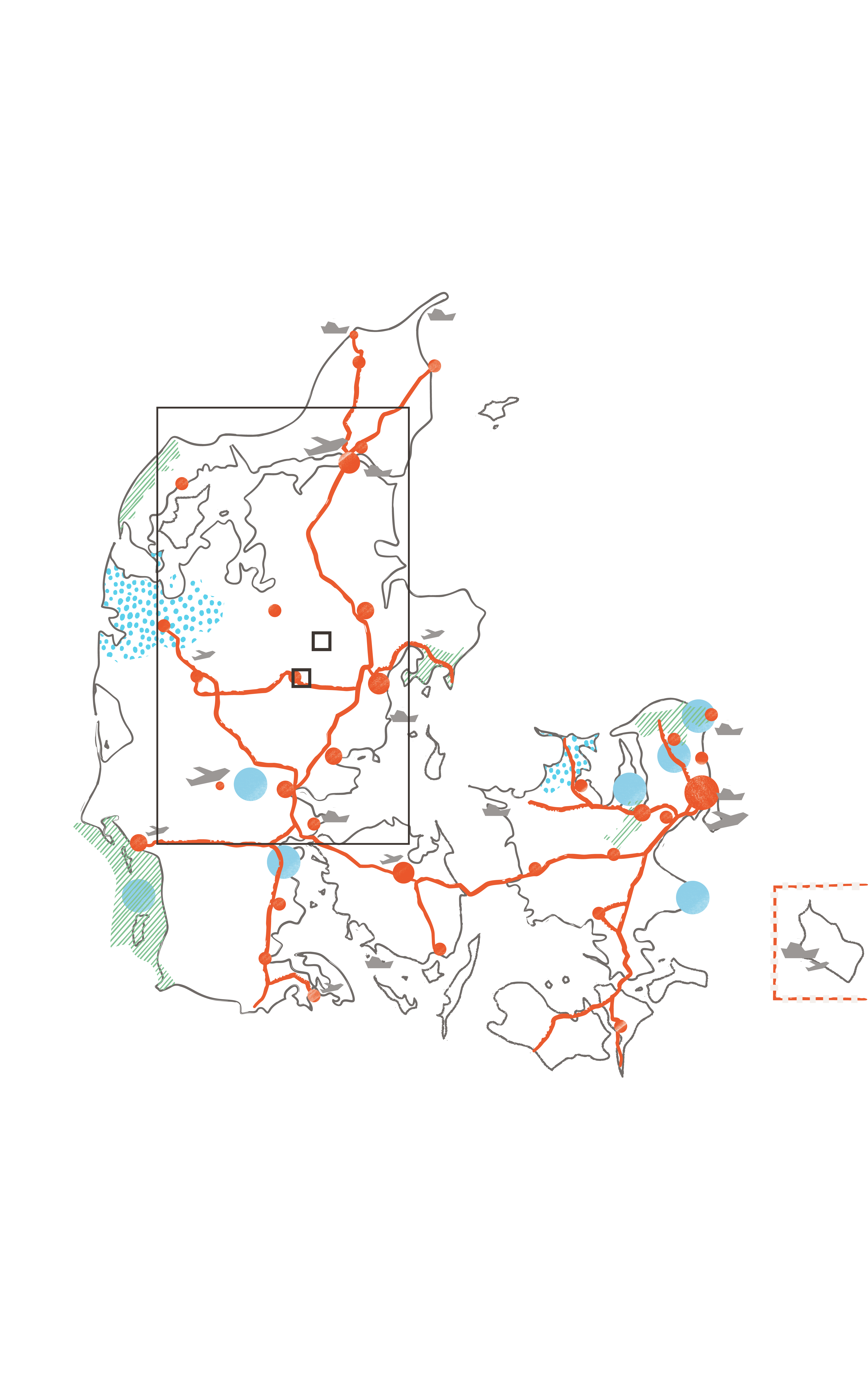
Cities and towns

National parks

UNESCO sites

UNESCO global geoparks

Main roads

Airports

Cruise ports

Case

Infrastructure

Walking path

Grass

Trees / Forest
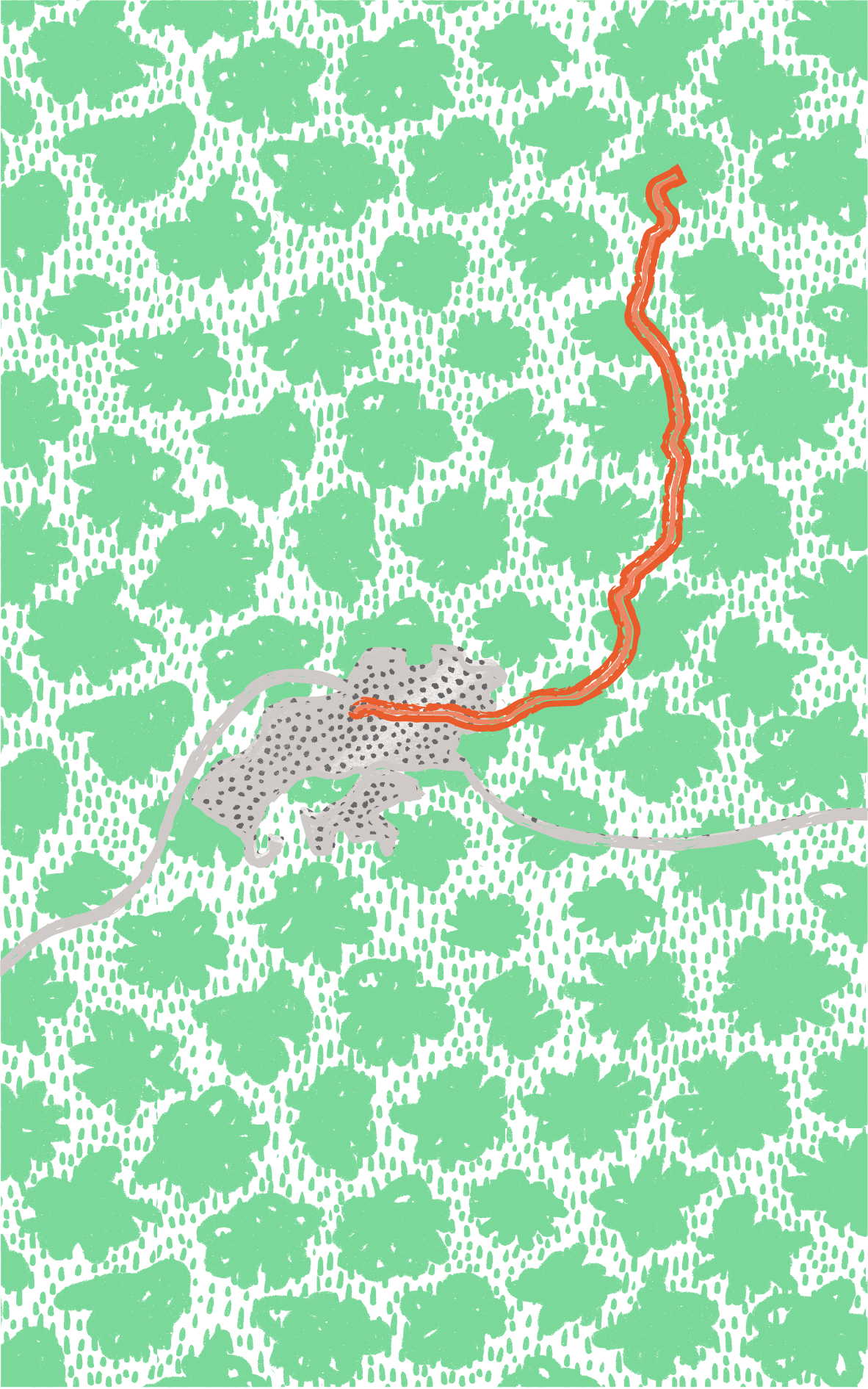
Frequent flooding
The Towpath along the Gudenå river between Silkeborg and Randers has been used for centuries to drag ships upstream. Throughout the industrial epoch, barge carriers and their draft horses were regular visitors. No longer in use as critical infrastructure, the towpath slowly deteriorated due to seasonal flooding and lack of maintenance. In 2016 Silkeborg Municipality opened a renovated and upgraded stretch between Silkeborg and Kongensbro, which is expected to be dry and passable for about ten months a year.
New recreational infrastructure
Today, the old towpath functions as a popular 76 km hiking trail, where the public can get close to the river and experience the varied surrounding landscape along the Gudenå river. Along the path are several cultural and recreational sites like the old and picturesque Svostrup Inn, ruins of an old monastery and active scout camps. The renovated part of the trail between Silkeborg and Kongensbro is either gravel or a simple boardwalk hovering above the wetlands. The upgraded trail is equipped with small benches, modest picnic areas, and uniform signage that provides information about the Towpath’s unique nature and cultural highlights.
Key facts
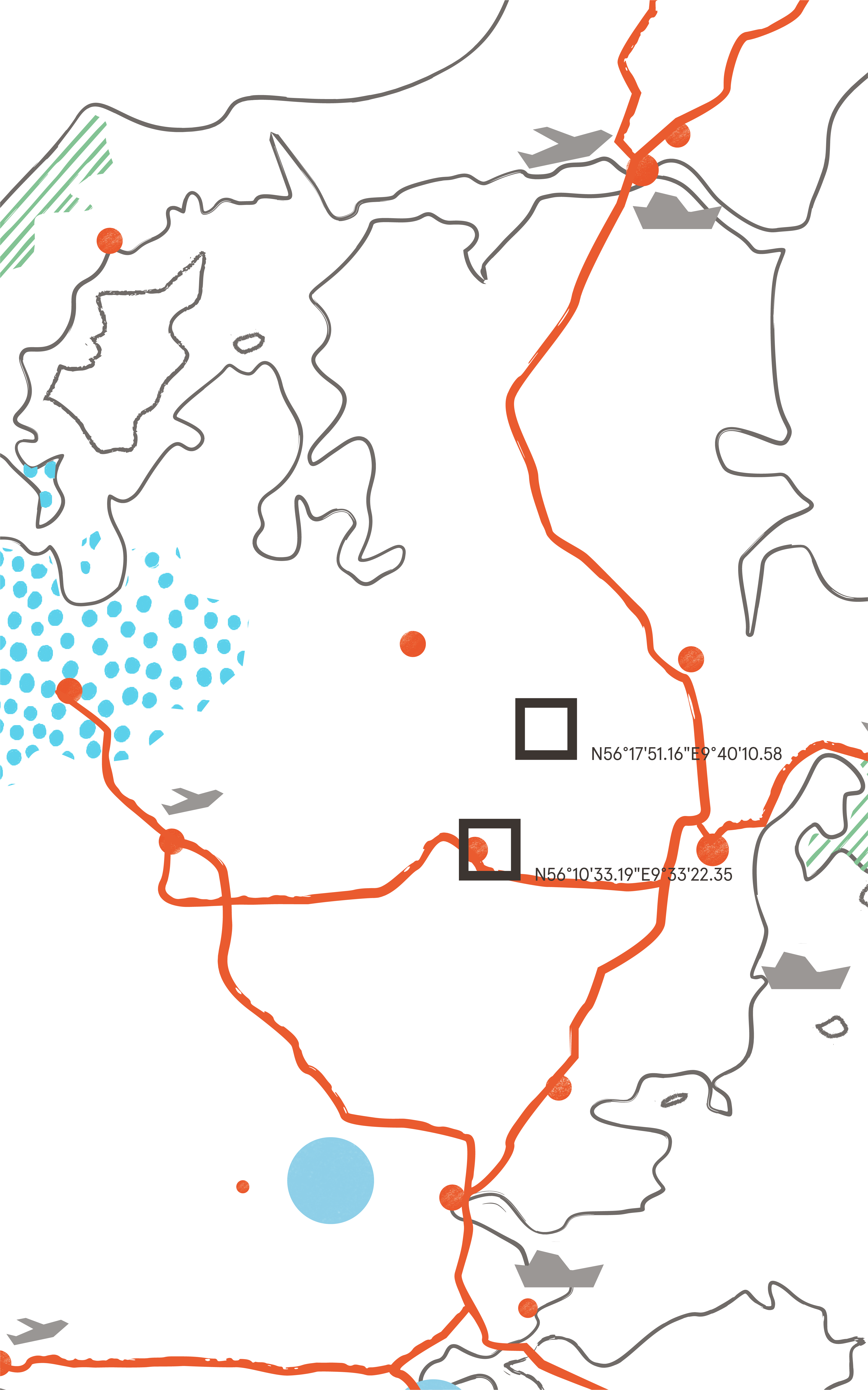
- Location
Along the Gudenå river between Silkeborg and Kongensbro
- GPS points
Southern anchor point: N56° 10’33.19’’ E9° 33’22.35’’ - Northern anchor point: N56° 17’51.16’’ E 9°40’10.58’’
- Protection Framework
Danish legislation
- Estimated number of visitors
- High season
- Low season
- Project Owner
Public - The Danish Nature Agency / Silkeborg Municipality
- Designer
- Year of construction
2017
- Materials
Timber, steel, gravel, and concrete
- Grants