
 Júlia Brekkan
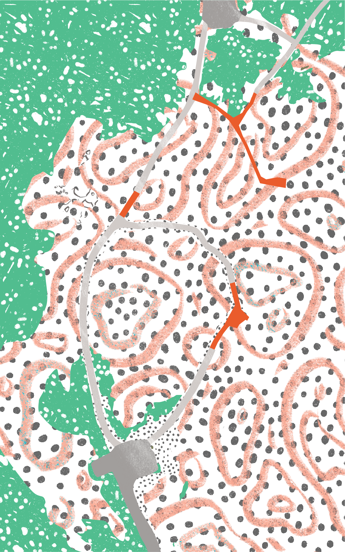
Gunnuhver Viewing Platforms
 Path
Path
Gunnuhver is a geothermal area that stands in the heart of Reykjanes UNESCO Global Geopark where the North Atlantic ridge rises from the ocean. The area is powerful due to volcanic activity and earthquakes and can therefore change without notice.
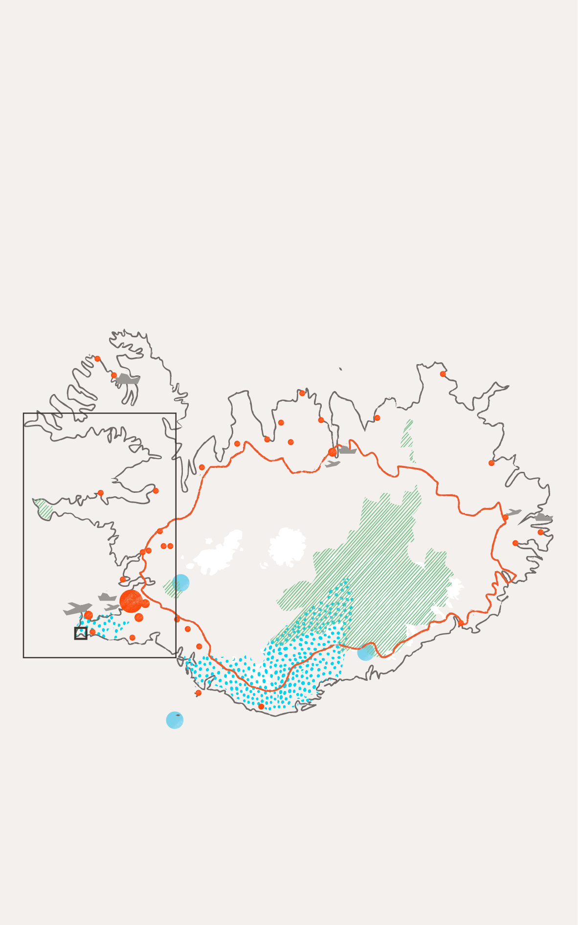
Cities and towns

National parks

UNESCO sites

UNESCO global geoparks

Main roads

Airports

Cruise ports

Case

Infrastructure

Paved road
Walking path
Sand / Gravel
Geothermal area

Moss / Vegetation
Ever-changing landscape
The area is very fragile and can change without notice, due to volcanic activity and earthquakes. The area is within the water conservation and the Environment Agency's natural heritage register.
Material choice for fragile nature
Gunnuhver is a geothermal area in a beautiful landscape where visitors can travel around on pathways and wooden platforms. The platforms are made from larch and are chosen to resemble existing natural materials. The main emphasis was to prevent the area from unnecessary damage, where disturbed areas should be rehabilitated with local vegetation and material.
Due to constant changes in the area, a steaming of the ground increased markedly as a consequence of a pressure drawdown in the geothermal reservoir upon the start of production from the reservoir in 2006. In 2010, new pathways and viewing platforms were put into use where there is access for everyone today. It is interesting to look into what materials and solutions are best suited for an ever-changing landscape such as Gunnuhver.
Key facts
- Location
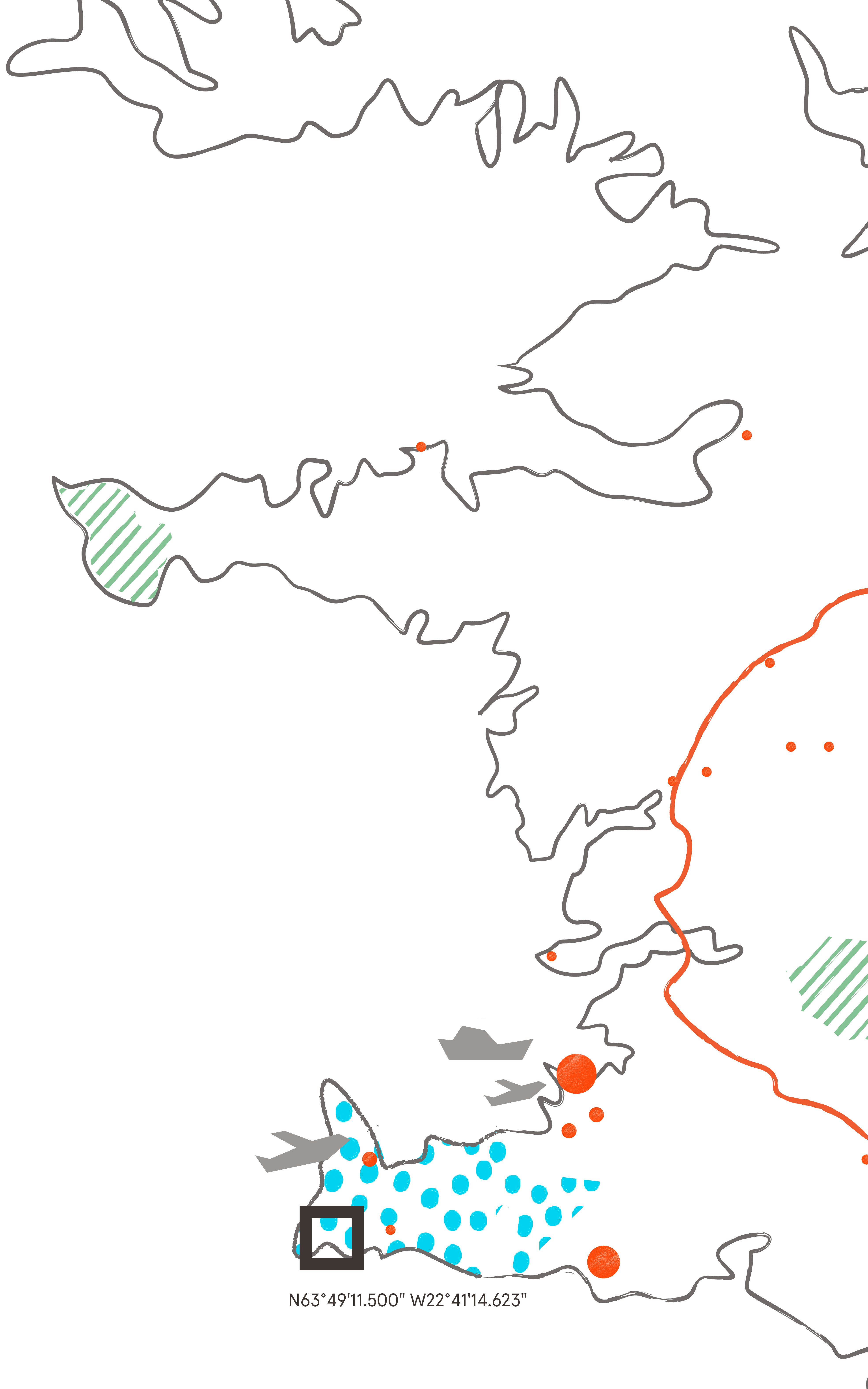
Gunnuhver, Reykjanes Geopark, SW Iceland
- GPS points
N63° 49' 09" W22° 41' 05"
- Protection Framework
UNESCO Global Geopark
- Estimated number of visitors a year
An average of 60,000 visitors per year
- High season
500 visitors per day on average
- Low season
100 visitors per day on average
- Project Owner
Brimketill is a state property located in the Grindavík area, managed by Reykjanes Geopark
- Designer
Landark Landscape Architects
- Year of construction
From 2006
- Materials
Mainly larch
- Grants
ISK 18,500,000 from the Tourist Site Protection Fund in 2017 and ISK 14,000,000 from The National Plan for the Development of Infrastructure in 2019