
 Júlía Brekkan
Grábrók Pathway
 Path
Path
With its magnificent views, the 170 m high Grábrók crater is a popular destination for hiking. Footpaths have been marked out and wooden steps have been installed, leading visitors safely up to the crater and at the same time protecting the delicate moss cover of the area.

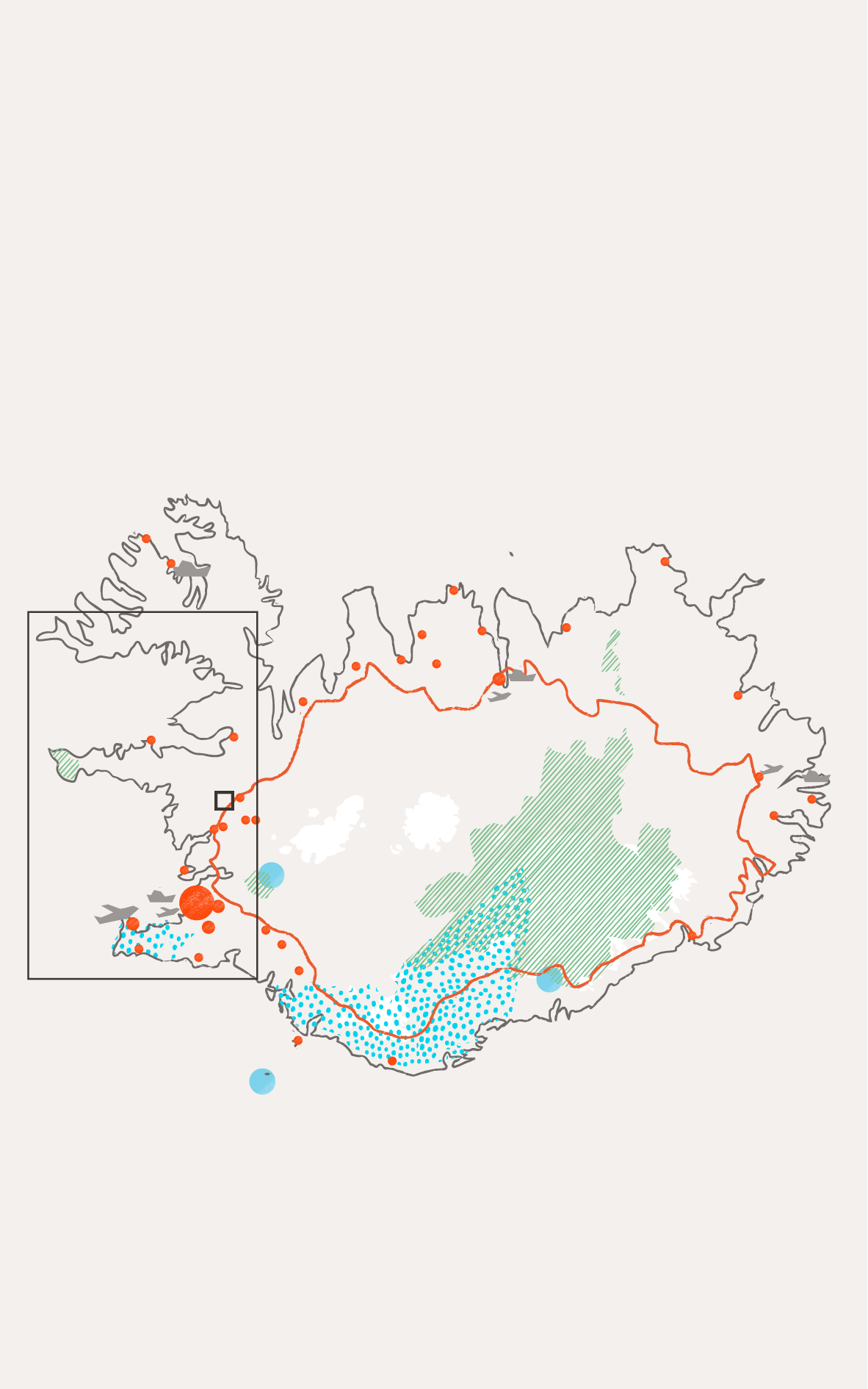
Cities and towns

National parks

UNESCO sites

UNESCO global geoparks

Main roads

Airports

Cruise ports

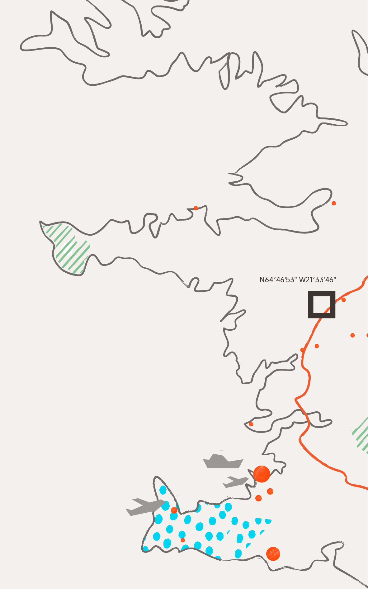
Case

Infrastructure

Paved road

Walking path

Sand / Gravel

Rocks / Cliffs
Lava

Moss / Vegetation

Grass

Trees / Forest
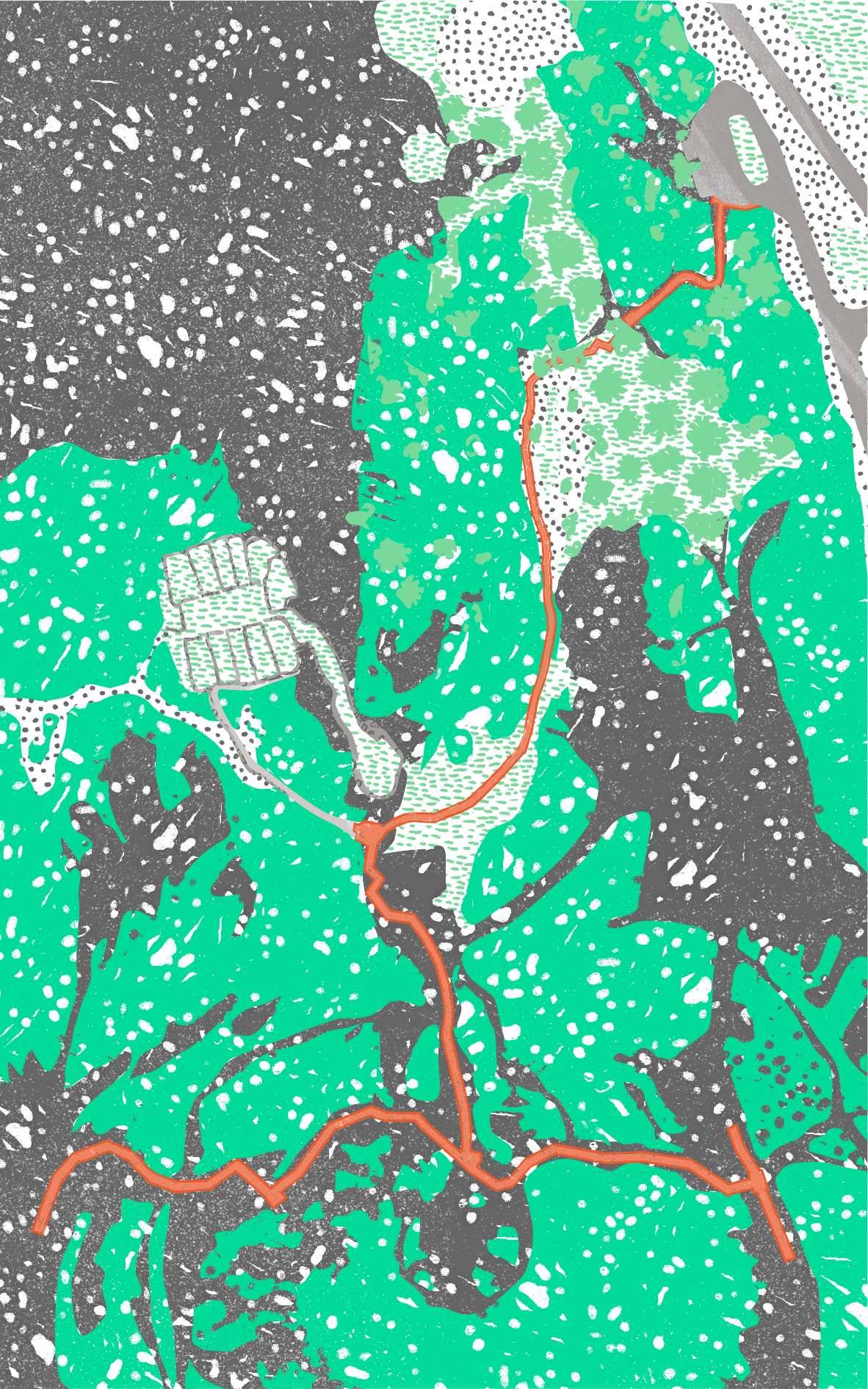
Popular and historic path in fragile nature
The area has sensitive geological formations and vegetation. A large influx of visitors has formed new paths and caused damage to the area, requiring costly efforts to stabilise and restore vegetation. Visitors tended to walk off the marked paths, thereby damaging the delicate moss cover, which led to the need to intervene. The wooden steps were carefully measured on-site and manufactured off-site, and then assembled at the Grábrók crater.
Removable platforms built by local craftsmen
The pathways and steps at the Grábrók crater were built to protect the natural landscape and react to the increasing pressure from tourism. To minimise disturbance, the wooden steps were built in units at a local carpentry workshop and then assembled on-site. The platform construction was kept simple, and the structure has been designed with the aim of minimising disturbance to the site. Iron poles were carefully drilled into the lava at different depths, and the platform’s steps were carefully laid on top of the soil. As visitors still tended to go off path, ropes and iron poles were installed for guidance. No concrete or similar materials were used in the construction. The infrastructure can therefore be removed again without leaving a trace.
Key facts
- Location
Grábrók Crater, Borgarbyggð municipality, W Iceland
- GPS points
N64° 46' 17.614" W21° 32' 23.370"
- Project Owner
Borgarbyggð Municipality on behalf of the Environment Agency of Iceland
- Protection Framework
National Monument
- Estimated number of visitors a year
About 76,000 per year
- High season
Around 530 guests per day (2018-2019)
- Low season
Around 20 guests per day (2018-2019)
- Materials
Imported pine, iron bars and ropes
- Designer
Eiríkur J. Ingólfsson ehf, commissioned by the landowners and the Environment Agency of Iceland
- Year of construction
Completed in 2015
- Grants
ISK 34,000,000 in the period 2014-2017 from the Tourist Site Protection Fund ISK 13,800,000 in the period 2018-2019 from the National Plan